GIS Mapping & Civil Engineering


Mapping Solutions That Move Projects Forward

Section Shape Image

Utilitra’s GIS and Civil Engineering team delivers precise, cost-effective solutions for utility, commercial, and public sector clients. With deep industry knowledge and a commitment to safety and compliance, we design systems that simplify complexity and accelerate progress. Whether collecting field data or coordinating large-scale designs, we tailor every solution to meet your goals—on time, on budget, and built to last.

IMG_0050
Shape Image One
Shape Image One
Precision and accuracy are at the heart of every mapping project we undertake. Our GIS team delivers comprehensive solutions, from precise field data collection to the final deliverable, ensuring reliable and timely results.
We collect and analyze data quickly and efficiently using advanced technology, including GPS systems, total stations, and laser scanning tools. This allows us to provide highly detailed, tailored mapping solutions for projects of any size, whether large-scale infrastructure or smaller, specialized needs.

Our Services Include:
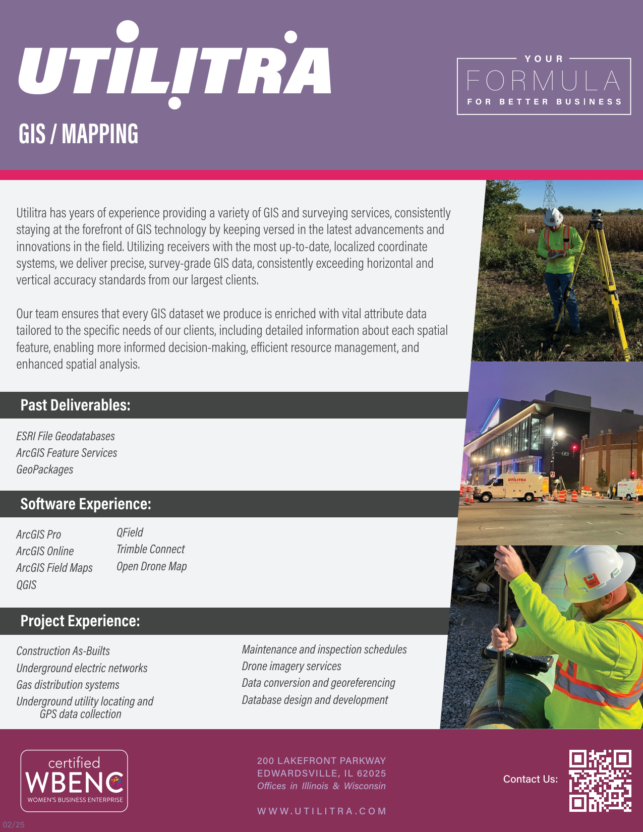
Section Shape Image

Accuracy Isn't Optional. It's Essential

Our GIS team delivers comprehensive mapping services, from field data collection through project completion, using advanced tools and deep utility expertise to ensure every deliverable is timely, precise, and built to your needs. Safely, efficiently, and cost-effectively.

1

Explore Our Capabilities

Learn how our design team brings precision and performance to every project we support.

  •  

GIS/Mapping

Download

Let's Build Success Together


Ready to take your project to the next level? Partner with Utilitra for
tailored civil engineering and GIS solutions that deliver results.


Shape Image One
Shape Image One
Shape Image One
Shape Image One